


Matheysine Le Colombier

c.gourme
User
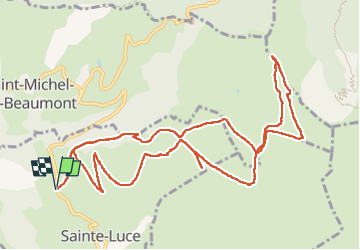

Length
13.7 km

Max alt
1939 m

Uphill gradient
766 m
Km-Effort
24 km

Min alt
1212 m

Downhill gradient
766 m
Boucle
Yes
Creation date :
2022-06-04 06:54:19.0
Updated on :
2022-06-04 19:12:25.486
5h01
Difficulty : Medium

FREE GPS app for hiking
 SityTrail
IGN / Geographical institutes
SityTrail Plus
The world is yours!
About
Trail Walking of 13.7 km to be discovered at Auvergne-Rhône-Alpes, Isère, Sainte-Luce. This trail is proposed by c.gourme.
Description
A faire que lorsque il n'y a pas de vache ! Pour monter au Colombier ,monter en suivant plustot le chemin en hauteur.
Positioning
Country:
France
Region :
Auvergne-Rhône-Alpes
Department/Province :
Isère
Municipality :
Sainte-Luce
Location:
Unknown
Start:(Dec)
Start:(UTM)
729490 ; 4971014 (31T) N.
Comments