Trail Horseback riding Gerbamont - 2022-06-05 Rando CVA Gerbamont Dommartin les Remiremont - Photo

2022-06-05 Rando CVA Gerbamont Dommartin les Remiremont

 holtzv
holtzv

User GUIDE

© OpenStreetMap contributors
Length
Length
24 km
Max alt
Max alt
872 m
Uphill gradient
Uphill gradient
703 m
Km-Effort
Km-Effort  
34 km
Min alt
Min alt
423 m
Downhill gradient
Downhill gradient
945 m
Boucle
Boucle
No
Creation date :
2022-06-05 07:30:55.886
Updated on :
2022-06-10 11:36:26.753

(0 Reviews)

Horseback riding
Horseback riding
5h10
Difficulty : Difficult

Scan this QR Code to open this trail in the SityTrail application

FREE GPS app for hiking

Logo SityTrail SityTrail

IGN / Geographical institutes

Download SityTrail from the App Store Download SityTrail from Google Play

Logo SityTrail SityTrail World

The world is yours!

Download SityTrail from the App Store Download SityTrail from Google Play Download SityTrail on Huawei AppGallery

About

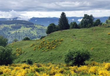
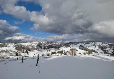
Trail Horseback riding of 24 km to be discovered at Grand Est, Vosges, Gerbamont. This trail is proposed by holtzv.

Description

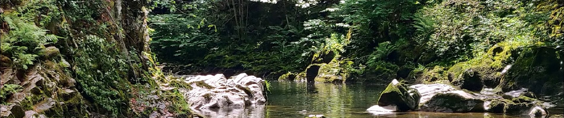
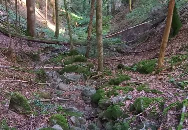
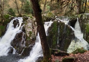
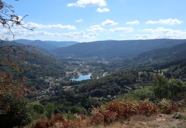
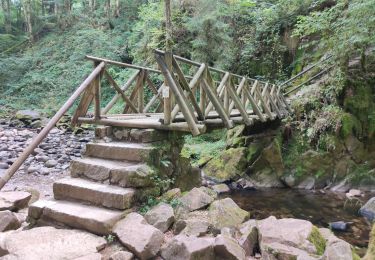
Journée entre la Ferme des Plateaux à Gerbamont et les Granges de Franould à Dommartin les Remiremont en passant par le col de la Burotte, les gorges de Crosery à Thiéfosse pour la pause déjeuner, le col de Xiard, le chalet des Meules, la roche Mortevieille et la grotte du loup

Elevation profile

Photos

Positioning

Country:
France
Region :
Grand Est
Department/Province :
Vosges
Municipality :
Gerbamont
Location:
Unknown
Start:(UTM)
334718 ; 5318255 (32T) N.

Trails nearby

Trail Walking La Bresse - Le Couchetat - Photo
Walking
fedinois1

Walking

Very easy
(2)
La Bresse, Grand Est, Vosges, France
4.8 km | 7.4 km-effort
1h 50min
Yes
Trail Horseback riding Gerbamont - 2022-06-04 Rando CVA Gerbamont Boucle Foret de Noire Goutte - Photo
Horseback riding
GUIDE
holtzv

Horseback riding

Very difficult
Gerbamont, Grand Est, Vosges, France
31 km | 43 km-effort
6h 2min
Yes
Trail Walking Saulxures-sur-Moselotte - circuit depuis col des Hayes  - Photo
Walking
Emmanuel Remy

Walking

Medium
(1)
Saulxures-sur-Moselotte, Grand Est, Vosges, France
5.2 km | 7.3 km-effort
1h 41min
Yes
Trail sport La Bresse - Lac du pré Thia Auberge du Couchetat au nord ouest de La Bresse jour 6 - Photo
sport
henriba

sport

Very easy
(1)
La Bresse, Grand Est, Vosges, France
11.3 km | 16.2 km-effort
Unknown
Yes
Trail Walking Thiéfosse - tiens vagbey gorge de croqery - Photo
Walking
ghislaine61

Walking

Medium
Thiéfosse, Grand Est, Vosges, France
8.9 km | 12 km-effort
2h 47min
Yes
Trail Walking Basse-sur-le-Rupt - Col de menufosse-chalet des charmes-pierre 4 communes  - Photo
Walking
Emmanuel Remy

Walking

Medium
(1)
Basse-sur-le-Rupt, Grand Est, Vosges, France
5 km | 6.6 km-effort
1h 29min
Yes
Trail Walking Gerbamont - cascadu bouchot vosges - Photo
Walking
ghislaine61

Walking

Medium
(1)
Gerbamont, Grand Est, Vosges, France
7.9 km | 10.5 km-effort
2h 23min
Yes
Trail Walking Thiéfosse - Randonnée du 23/08/2022 à 17:17 - Photo
Walking
nfranche

Walking

Very difficult
Thiéfosse, Grand Est, Vosges, France
18.5 km | 28 km-effort
6h 19min
Yes
Trail Walking Rochesson - Les Roches Saint-Jacques et la Cascade du Bouchot - Photo
Walking
JJG54

Walking

Difficult
Rochesson, Grand Est, Vosges, France
15.6 km | 24 km-effort
6h 29min
Yes


Close
My subscriptions