


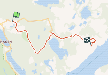
Montée du camping au sommet du Preikestolen

dudu79
User

Length
9.6 km

Max alt
696 m

Uphill gradient
708 m
Km-Effort
17.2 km

Min alt
112 m

Downhill gradient
139 m
Boucle
No
Creation date :
2022-06-05 20:26:37.41
Updated on :
2022-06-05 20:28:16.725
3h54
Difficulty : Difficult

FREE GPS app for hiking
 SityTrail
IGN / Geographical institutes
SityTrail Plus
The world is yours!
About
Trail Walking of 9.6 km to be discovered at Rogaland. This trail is proposed by dudu79.
Description
Contourner le golf
Positioning
Country:
Norway
Region :
Rogaland
Department/Province :
Unknown
Municipality :
Unknown
Location:
Unknown
Start:(Dec)
Start:(UTM)
333099 ; 6543595 (32V) N.
Comments