Trail Walking Champs-sur-Tarentaine-Marchal - champ sur Tarentaine - Photo
© OpenStreetMap contributors
Length
Length
9.1 km
Max alt
Max alt
620 m
Uphill gradient
Uphill gradient
296 m
Km-Effort
Km-Effort  
13.1 km
Min alt
Min alt
479 m
Downhill gradient
Downhill gradient
296 m
Boucle
Boucle
Yes
Creation date :
2022-06-06 07:22:27.18
Updated on :
2022-06-06 10:30:16.991

(1 Reviews)

Walking
Walking
2h58
Difficulty : Easy

Scan this QR Code to open this trail in the SityTrail application

FREE GPS app for hiking

Logo SityTrail SityTrail

IGN / Geographical institutes

Download SityTrail from the App Store Download SityTrail from Google Play

Logo SityTrail SityTrail World

The world is yours!

Download SityTrail from the App Store Download SityTrail from Google Play Download SityTrail on Huawei AppGallery

About

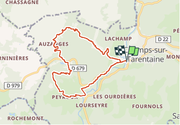
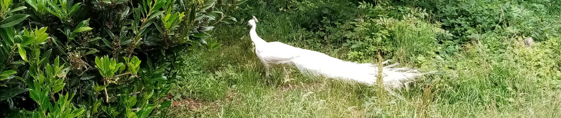
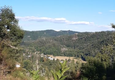
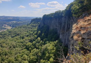
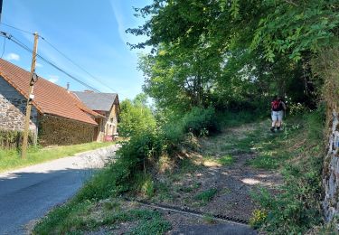
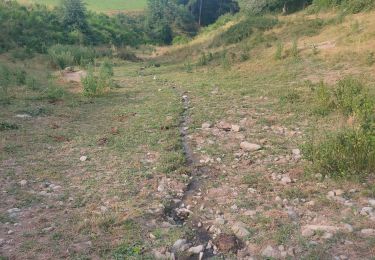
Trail Walking of 9.1 km to be discovered at Auvergne-Rhône-Alpes, Cantal, Champs-sur-Tarentaine-Marchal. This trail is proposed by mimi69670.

Description

Rando autour de champ sur tarentaine

Elevation profile

Photos

Positioning

Country:
France
Region :
Auvergne-Rhône-Alpes
Department/Province :
Cantal
Municipality :
Champs-sur-Tarentaine-Marchal
Location:
Champs-sur-Tarentaine
Start:(UTM)
465186 ; 5026797 (31T) N.

Comments

Please log in to post a review or rate the element


Trails nearby

Trail Walking Champs-sur-Tarentaine-Marchal - La balade de Peyroux - Photo
Walking
fb427447

Walking

Medium
Champs-sur-Tarentaine-Marchal, Auvergne-Rhône-Alpes, Cantal, France
8.2 km | 11.4 km-effort
2h 16min
Yes
Trail Walking Bort-les-Orgues - Les Orgues de Bort-les-Orgues - Photo
Walking
VacheKiri67

Walking

Difficult
Bort-les-Orgues, New Aquitaine, Corrèze, France
9.4 km | 15.1 km-effort
3h 28min
Yes
Trail Walking Bort-les-Orgues - 20210613 Bort Les Orgues - Photo
Walking
Childebert

Walking

Medium
Bort-les-Orgues, New Aquitaine, Corrèze, France
7.5 km | 12.3 km-effort
4h 18min
Yes
Trail Trail Bort-les-Orgues - Bort château de val - Photo
Trail
Giraud34

Trail

Difficult
Bort-les-Orgues, New Aquitaine, Corrèze, France
9 km | 12.2 km-effort
1h 20min
No
Trail Walking Lanobre - rando château de val - Photo
Walking
MarcBoscher

Walking

Medium
Lanobre, Auvergne-Rhône-Alpes, Cantal, France
6.9 km | 9 km-effort
2h 56min
No
Trail Walking Bort-les-Orgues - Dordogne_integrale - Photo
Walking
frederic.farge

Walking

Difficult
(1)
Bort-les-Orgues, New Aquitaine, Corrèze, France
153 km | 220 km-effort
41h 47min
No
Trail Walking Lanobre - lanobre - Photo
Walking
kronio

Walking

Very easy
Lanobre, Auvergne-Rhône-Alpes, Cantal, France
17.8 km | 24 km-effort
4h 53min
Yes
Trail Walking Vebret - Chesseix - Photo
Walking
Michelraimbault

Walking

Easy
Vebret, Auvergne-Rhône-Alpes, Cantal, France
7.6 km | 9.8 km-effort
2h 19min
Yes
Trail Walking Lanobre - lanobre château de Val - Photo
Walking
MarcBoscher

Walking

Medium
Lanobre, Auvergne-Rhône-Alpes, Cantal, France
5.4 km | 6.9 km-effort
1h 35min
Yes


Close
My subscriptions