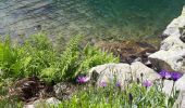
Trail Walking Valdieri - Lac et refuge Bianco - Photo

Lac et refuge Bianco

 GrouGary
GrouGary

User

© OpenStreetMap contributors
Length
Length
16.7 km
Max alt
Max alt
1894 m
Uphill gradient
Uphill gradient
929 m
Km-Effort
Km-Effort  
29 km
Min alt
Min alt
983 m
Downhill gradient
Downhill gradient
931 m
Boucle
Boucle
Yes
Creation date :
2022-06-05 06:57:28.081
Updated on :
2022-06-10 11:44:32.835

(0 Reviews)

Walking
Walking
4h59
Difficulty : Medium

Scan this QR Code to open this trail in the SityTrail application

FREE GPS app for hiking

Logo SityTrail SityTrail

IGN / Geographical institutes

Download SityTrail from the App Store Download SityTrail from Google Play

Logo SityTrail SityTrail Plus

The world is yours!

Download SityTrail from the App Store Download SityTrail from Google Play Download SityTrail on Huawei AppGallery

About

Trail Walking of 16.7 km to be discovered at Piemont, Cuneo, Valdieri. This trail is proposed by GrouGary.

Description

Bel A/R sur le GR à partir du village de Sant'Anna di Valdieri
930 et 17 km.
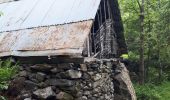
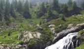
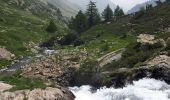
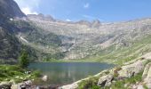
Une des plus belles montées, longeant un beau torrent et cascades, jusqu'au Lago Sottano della Sella.
Lys orangers, Asphodèles, Géraniums violets, Ancolies roses/mauves/violettes, Trolles, Campanules, Bugles pyramidales, Doronics, Gentianes acaules, Centaurées, ... Partout des fleurs ! un 5 juin
Pic Nic face au Lac et Refuge Bianco

Elevation profile

Photos

Positioning

Country:
Italy
Region :
Piemont
Department/Province :
Cuneo
Municipality :
Valdieri
Location:
Unknown
Start:(UTM)
366026 ; 4900292 (32T) N.


Close
My subscriptions