


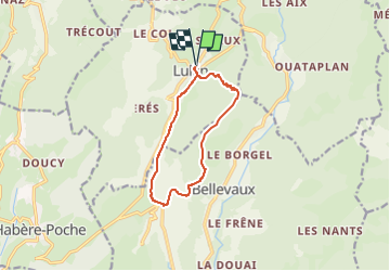
Les granges de Lullin

cron
User

Length
10.2 km

Max alt
1366 m

Uphill gradient
571 m
Km-Effort
17.8 km

Min alt
846 m

Downhill gradient
571 m
Boucle
Yes
Creation date :
2022-06-08 20:24:39.163
Updated on :
2022-08-19 20:43:07.944
3h54
Difficulty : Medium

FREE GPS app for hiking
 SityTrail
IGN / Geographical institutes
SityTrail Plus
The world is yours!
About
Trail Walking of 10.2 km to be discovered at Auvergne-Rhône-Alpes, Upper Savoy, Lullin. This trail is proposed by cron.
Positioning
Country:
France
Region :
Auvergne-Rhône-Alpes
Department/Province :
Upper Savoy
Municipality :
Lullin
Location:
Unknown
Start:(Dec)
Start:(UTM)
309215 ; 5128650 (32T) N.
Comments