


la badine Port Auguier et Port du Niel

Yot
User
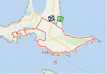

Length
13 km

Max alt
57 m

Uphill gradient
242 m
Km-Effort
16.2 km

Min alt
0 m

Downhill gradient
246 m
Boucle
Yes
Creation date :
2022-06-09 06:51:55.544
Updated on :
2022-06-09 16:03:08.441
5h04
Difficulty : Easy

FREE GPS app for hiking
 SityTrail
IGN / Geographical institutes
SityTrail Plus
The world is yours!
About
Trail Walking of 13 km to be discovered at Provence-Alpes-Côte d'Azur, Var, Hyères. This trail is proposed by Yot.
Positioning
Country:
France
Region :
Provence-Alpes-Côte d'Azur
Department/Province :
Var
Municipality :
Hyères
Location:
Unknown
Start:(Dec)
Start:(UTM)
267684 ; 4769135 (32T) N.
Comments