Trail  Saint-Privat-du-Fau - Les hameaux de Saint-Privat-du-Fau - Photo

Les hameaux de Saint-Privat-du-Fau

© OpenStreetMap contributors
Length
Length
11.7 km
Max alt
Max alt
1219 m
Uphill gradient
Uphill gradient
345 m
Km-Effort
Km-Effort  
16.3 km
Min alt
Min alt
917 m
Downhill gradient
Downhill gradient
353 m
Boucle
Boucle
Yes
Creation date :
2022-06-09 15:59:10.561
Updated on :
2022-06-09 16:00:21.149

(0 Reviews)


Scan this QR Code to open this trail in the SityTrail application

FREE GPS app for hiking

Logo SityTrail SityTrail

IGN / Geographical institutes

Download SityTrail from the App Store Download SityTrail from Google Play

Logo SityTrail SityTrail World

The world is yours!

Download SityTrail from the App Store Download SityTrail from Google Play Download SityTrail on Huawei AppGallery

About

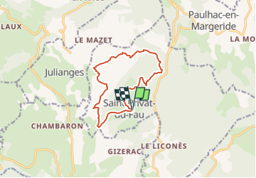
Trail of 11.7 km to be discovered at Occitania, Lozère, Saint-Privat-du-Fau. This trail is proposed by guitounette.

Elevation profile

Points of interest

Point of interest Saint-Privat-du-Fau - Petit parking sous l'église - Photo
guitounette
SAINT-PRIVAT-DU-FAU 
Point of interest Saint-Privat-du-Fau - Intersection - Photo
guitounette
SAINT-PRIVAT-DU-FAU 
Point of interest Saint-Privat-du-Fau - Croix de granite - Photo
guitounette
SAINT-PRIVAT-DU-FAU 
Point of interest Saint-Privat-du-Fau - Hameau Le Villard Grand - Photo
guitounette
SAINT-PRIVAT-DU-FAU 
Point of interest Saint-Privat-du-Fau - Hameau La Vacheresse - Photo
guitounette
SAINT-PRIVAT-DU-FAU 
Point of interest Saint-Privat-du-Fau - Jonction route - Photo
guitounette
SAINT-PRIVAT-DU-FAU 
Point of interest Saint-Privat-du-Fau - Intersection - Photo
guitounette
SAINT-PRIVAT-DU-FAU 
Point of interest Saint-Privat-du-Fau - Cros de Maury - Photo
guitounette
SAINT-PRIVAT-DU-FAU 
Point of interest Saint-Privat-du-Fau - Intersection GRP Tour de la Margeride - Photo
guitounette
SAINT-PRIVAT-DU-FAU 
Point of interest Saint-Privat-du-Fau -  Fourche - Photo
guitounette
SAINT-PRIVAT-DU-FAU 
Point of interest Saint-Privat-du-Fau - Ruisseau - Photo
guitounette
SAINT-PRIVAT-DU-FAU 
Point of interest Saint-Privat-du-Fau - Sortie du village (étable) - Photo
guitounette
SAINT-PRIVAT-DU-FAU 
Point of interest Saint-Privat-du-Fau - Petit parking sous l'église - Photo
guitounette
SAINT-PRIVAT-DU-FAU 

Positioning

Country:
France
Region :
Occitania
Department/Province :
Lozère
Municipality :
Saint-Privat-du-Fau
Location:
Unknown
Start:(UTM)
526994 ; 4973765 (31T) N.

Trails nearby

Trail On foot Paulhac-en-Margeride - La Molle - Photo
On foot
guitounette

On foot

Easy
(2)
Paulhac-en-Margeride, Occitania, Lozère, France
8.5 km | 12 km-effort
2h 42min
Yes
Trail Walking Paulhac-en-Margeride - Tour du mont Mouchet - Photo
Walking
pgeiger

Walking

Very easy
Paulhac-en-Margeride, Occitania, Lozère, France
10.5 km | 14.4 km-effort
5h 2min
Yes
Trail Equestrian Le Malzieu-Forain - MAJ 21 DRAILLE EN MARGERIDE 2eme partie vers Saugues - Photo
Equestrian
Lozère Cheval

Equestrian

Very easy
Le Malzieu-Forain, Occitania, Lozère, France
50 km | 64 km-effort
Unknown
Yes
Trail Horseback riding Le Malzieu-Forain - Etoile Première boucle  Pré hiver 25 km - Photo
Horseback riding
Lozère Cheval

Horseback riding

Easy
Le Malzieu-Forain, Occitania, Lozère, France
25 km | 36 km-effort
1h 4min
No
Trail Moto cross Paulhac-en-Margeride - paulhac en margeride/brioude 5jours 2024 - Photo
Moto cross
frank12

Moto cross

Easy
Paulhac-en-Margeride, Occitania, Lozère, France
91 km | 131 km-effort
Unknown
No
Trail Moto cross Paulhac-en-Margeride - paulhac en margeride/brioude 5jours 2024 version 2 - Photo
Moto cross
frank12

Moto cross

Easy
Paulhac-en-Margeride, Occitania, Lozère, France
116 km | 167 km-effort
Unknown
No
Trail Walking Blavignac - Les balcons de la Truyère - Photo
Walking
guitounette

Walking

Very difficult
Blavignac, Occitania, Lozère, France
16.6 km | 26 km-effort
5h 49min
Yes
Trail Walking Paulhac-en-Margeride - Paulhac en Margeride - Photo
Walking
boyer43

Walking

Very difficult
Paulhac-en-Margeride, Occitania, Lozère, France
27 km | 38 km-effort
8h 42min
Yes
Trail Walking Paulhac-en-Margeride - autour de Paulhac - Photo
Walking
Dessalien

Walking

Easy
Paulhac-en-Margeride, Occitania, Lozère, France
8.6 km | 11.6 km-effort
2h 42min
Yes


Close
My subscriptions