


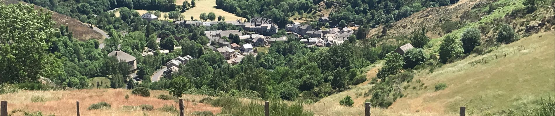
Le Bleymard Le Pont de Montvert

Roger Philippe Wallez
User GUIDE
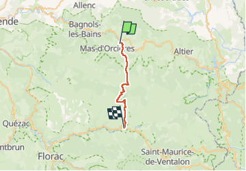

Length
20 km

Max alt
1699 m

Uphill gradient
675 m
Km-Effort
30 km

Min alt
899 m

Downhill gradient
843 m
Boucle
No
Creation date :
2022-06-10 06:39:21.0
Updated on :
2022-06-10 13:32:15.313
6h50
Difficulty : Difficult

FREE GPS app for hiking
 SityTrail
IGN / Geographical institutes
SityTrail Plus
The world is yours!
About
Trail Walking of 20 km to be discovered at Occitania, Lozère, Mont Lozère et Goulet. This trail is proposed by Roger Philippe Wallez.
Photos


Positioning
Country:
France
Region :
Occitania
Department/Province :
Lozère
Municipality :
Mont Lozère et Goulet
Location:
Unknown
Start:(Dec)
Start:(UTM)
558411 ; 4926133 (31T) N.
Comments