Trail On foot Villefort - J1:Villefort-Mas de la Barque - Photo

J1:Villefort-Mas de la Barque

© OpenStreetMap contributors
Length
Length
14.4 km
Max alt
Max alt
1455 m
Uphill gradient
Uphill gradient
972 m
Km-Effort
Km-Effort  
25 km
Min alt
Min alt
584 m
Downhill gradient
Downhill gradient
157 m
Boucle
Boucle
No
Creation date :
2022-06-10 13:54:21.219
Updated on :
2022-06-23 08:06:01.602

(0 Reviews)

On foot
On foot
5h36
Difficulty : Medium
Walking
Walking
5h36
Difficulty : Difficult

Scan this QR Code to open this trail in the SityTrail application

FREE GPS app for hiking

Logo SityTrail SityTrail

IGN / Geographical institutes

Download SityTrail from the App Store Download SityTrail from Google Play

Logo SityTrail SityTrail World

The world is yours!

Download SityTrail from the App Store Download SityTrail from Google Play Download SityTrail on Huawei AppGallery

About

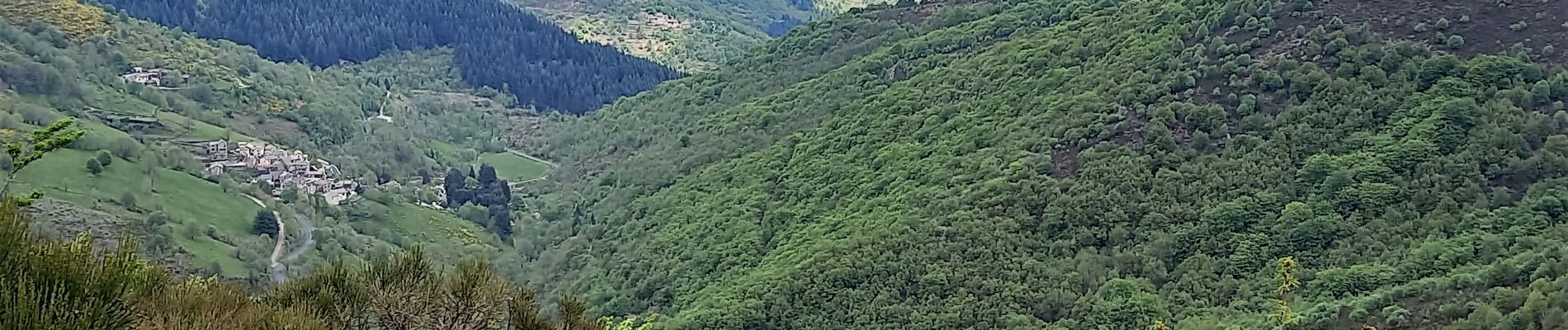
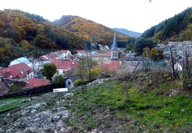
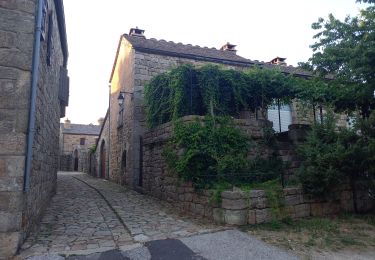
Trail On foot of 14.4 km to be discovered at Occitania, Lozère, Villefort. This trail is proposed by canardDenis.

Description

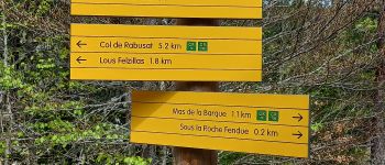
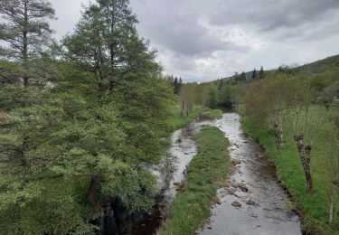
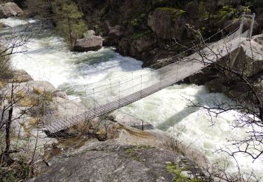
Cet itinéraire "au long du Tarn" est largement inspiré par le nouveau GR®736 balisé par la Fédérarion Française de Randonnée Pédestre. En attendant le topoguide en préparation découvrons son parcours en allant chercher le Tarn à sa source et en le suivant jusqu'aux portes d'Albi.,
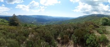
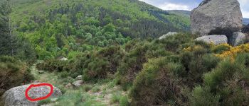
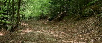
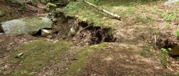
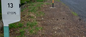
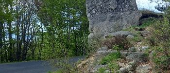
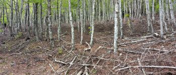
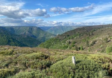
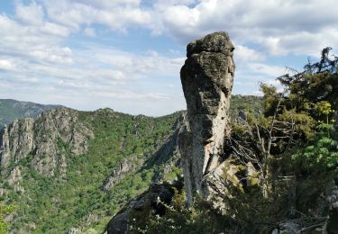
Cette première étape démarre de Villefort. Un premier jour pour tester sa forme avec presque 900mètres de montée vers le Mont Lozère où se cachent les sources.

Elevation profile

Photos

Points of interest

Point of interest Villefort - VILLEFORT-gare - Photo
canardDenis
VILLEFORT 
Point of interest Villefort - GR68 balisé à droite  - Photo
canardDenis
Point of interest Villefort - fin du goudron GR à gauche toujours en montée  - Photo
canardDenis
Point of interest Villefort - prendre à gauche  - Photo
canardDenis
Point of interest Villefort - continuer piste à droite - Photo
canardDenis
Point of interest Villefort - épingle à  gauche - Photo
canardDenis
Point of interest Saint-André-Capcèze - plo de la Voulp à 982m,montée droite de 132m - Photo
canardDenis
SAINT-ANDRÉ-CAPCÈZE 
Point of interest Saint-André-Capcèze - La Taillade - Photo
canardDenis
SAINT-ANDRÉ-CAPCÈZE 
Point of interest Pourcharesses - piste entre blocs à gauche puis à droite - Photo
canardDenis
Point of interest Pourcharesses - T dan granite au sommet - Photo
canardDenis
Point of interest Pourcharesses - à droite en 11 puis tout droit balise GR sur roche - Photo
canardDenis
Point of interest Pourcharesses - Suivre GR72-GR736 à droite  - Photo
canardDenis
Point of interest Pourcharesses - Tracé modifié-suivre balisage - Photo
canardDenis
Point of interest Ponteils-et-Brésis - balise Le Mouniau-prendre sentier à droite - Photo
canardDenis
PONTEILS-ET-BRÉSIS 
Point of interest Pourcharesses - tourner à droite à l'arbre cassé,ça monte dur dans la haitraie  - Photo
canardDenis
Point of interest Pourcharesses - arrivée sur piste à droite  - Photo
canardDenis
Point of interest Pourcharesses - Le ruisseau coule bien et a provoqué éboulement  - Photo
canardDenis
Point of interest Pourcharesses - croise nouvelle ligne électrique  - Photo
canardDenis
Point of interest Pourcharesses - prendre goudron à gauche - Photo
canardDenis
Point of interest Pourcharesses - quitter goudron sentier droite - Photo
canardDenis
Point of interest Concoules - arrivée route- la suivre à gauche - Photo
canardDenis
Point of interest Pourcharesses - quitter goudron piste à droite  - Photo
canardDenis
Point of interest Vialas - hêtraie - Photo
canardDenis
VIALAS 

Positioning

Country:
France
Region :
Occitania
Department/Province :
Lozère
Municipality :
Villefort
Location:
Unknown
Start:(UTM)
573529 ; 4921118 (31T) N.

Trails nearby

Trail Walking Pied-de-Borne - GRP Tour du Chassezac en 2 jours - Photo
Walking
GUIDE
nadinebondoux

Walking

Difficult
Pied-de-Borne, Occitania, Lozère, France
25 km | 36 km-effort
6h 50min
No
Trail On foot Malons-et-Elze - GR 44 - Photo
On foot
PRO

On foot

Easy
Malons-et-Elze, Occitania, Gard, France
4.8 km | 6.4 km-effort
1h 26min
No
Trail Walking Prévenchères -  Gorges de Chassezac - Photo
Walking
cousam

Walking

Difficult
Prévenchères, Occitania, Lozère, France
19 km | 30 km-effort
7h 33min
Yes
Trail Walking Pied-de-Borne - Le tour du Chassezac  - Photo
Walking
GUIDE
Roger Philippe Wallez

Walking

Very difficult
Pied-de-Borne, Occitania, Lozère, France
49 km | 72 km-effort
37h 28min
Yes
Trail Walking Pied-de-Borne - Le tour du chassezac - Photo
Walking
GUIDE
Roger Philippe Wallez

Walking

Very difficult
Pied-de-Borne, Occitania, Lozère, France
49 km | 72 km-effort
16h 34min
Yes
Trail Walking Prévenchères - La garde guerin  - Photo
Walking
GUIDE
antignacs

Walking

Very easy
Prévenchères, Occitania, Lozère, France
6.1 km | 7.4 km-effort
1h 39min
Yes
Trail Walking Prévenchères - Gorges du Chassezac au départ de la Garde guérin  - Photo
Walking
GUIDE
nadinebondoux

Walking

Difficult
Prévenchères, Occitania, Lozère, France
10 km | 17.2 km-effort
4h 3min
Yes
Trail Walking Prévenchères - La Garde Guerin - Photo
Walking
sylvain.cano

Walking

Very difficult
Prévenchères, Occitania, Lozère, France
12.4 km | 21 km-effort
5h 5min
Yes
Trail Walking Pourcharesses - tour du lac de Villefort et chapelle Saint Loup.  - Photo
Walking
dcharbonnier

Walking

Easy
Pourcharesses, Occitania, Lozère, France
9 km | 12.8 km-effort
3h 53min
No


Close
My subscriptions