


sireixCabalirosG2 fait 2022

LouisROGER
User GUIDE
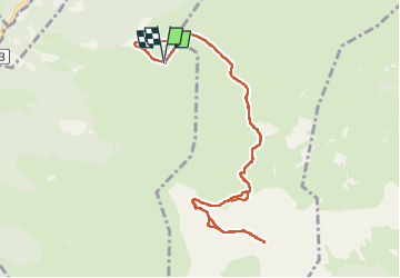

Length
11.4 km

Max alt
2326 m

Uphill gradient
773 m
Km-Effort
22 km

Min alt
1590 m

Downhill gradient
773 m
Boucle
Yes
Creation date :
2022-06-10 07:47:57.008
Updated on :
2022-06-10 14:49:01.397
5h59
Difficulty : Very difficult

FREE GPS app for hiking
 SityTrail
IGN / Geographical institutes
SityTrail Plus
The world is yours!
About
Trail Walking of 11.4 km to be discovered at Occitania, Hautespyrenees, Arras-en-Lavedan. This trail is proposed by LouisROGER.
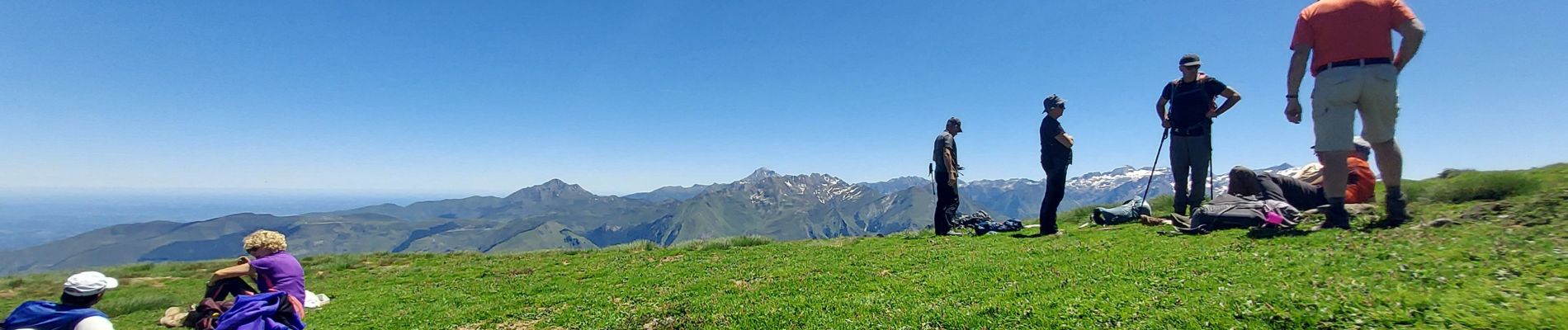
Photos


Positioning
Country:
France
Region :
Occitania
Department/Province :
Hautespyrenees
Municipality :
Arras-en-Lavedan
Location:
Unknown
Start:(Dec)
Start:(UTM)
733192 ; 4759266 (30T) N.
Comments