


2022-06-11_20h18m09_9467524.gpx (1)

geoffrayLayeux
User
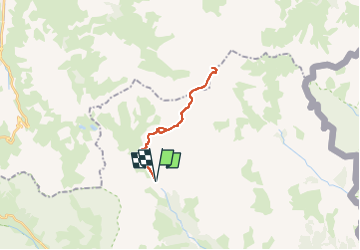

Length
19.6 km

Max alt
3168 m

Uphill gradient
1330 m
Km-Effort
37 km

Min alt
2024 m

Downhill gradient
1330 m
Boucle
Yes
Creation date :
2022-06-11 18:18:09.374
Updated on :
2022-06-11 18:19:08.073
8h28
Difficulty : Very difficult

FREE GPS app for hiking
 SityTrail
IGN / Geographical institutes
SityTrail Plus
The world is yours!
About
Trail Walking of 19.6 km to be discovered at Provence-Alpes-Côte d'Azur, Hautes-Alpes, Névache. This trail is proposed by geoffrayLayeux.
Positioning
Country:
France
Region :
Provence-Alpes-Côte d'Azur
Department/Province :
Hautes-Alpes
Municipality :
Névache
Location:
Unknown
Start:(Dec)
Start:(UTM)
305178 ; 4992520 (32T) N.
Comments