


2022-06-13_11h49m04_SityTrail - 2300999 - port-lagaden-pm-9,7km

LaurentBernard
User
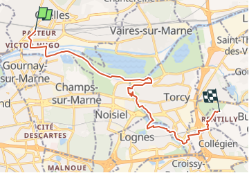

Length
13.7 km

Max alt
104 m

Uphill gradient
130 m
Km-Effort
15.3 km

Min alt
35 m

Downhill gradient
86 m
Boucle
No
Creation date :
2022-06-13 09:49:04.936
Updated on :
2022-07-02 06:49:22.017

FREE GPS app for hiking
 SityTrail
IGN / Geographical institutes
SityTrail Plus
The world is yours!
About
Trail of 13.7 km to be discovered at Ile-de-France, Seine-et-Marne, Chelles. This trail is proposed by LaurentBernard.
Positioning
Country:
France
Region :
Ile-de-France
Department/Province :
Seine-et-Marne
Municipality :
Chelles
Location:
Unknown
Start:(Dec)
Start:(UTM)
469387 ; 5413512 (31U) N.
Comments