


CR_Francigena_CG_30_Aulla_Sarzana_20220613

patrickdanilo
User
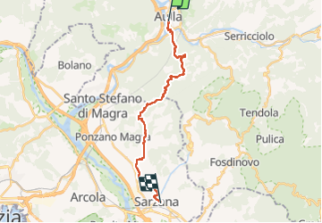

Length
20 km

Max alt
545 m

Uphill gradient
687 m
Km-Effort
29 km

Min alt
24 m

Downhill gradient
717 m
Boucle
No
Creation date :
2022-06-13 05:47:59.245
Updated on :
2022-07-26 10:32:54.354
6h06
Difficulty : Difficult

FREE GPS app for hiking
 SityTrail
IGN / Geographical institutes
SityTrail Plus
The world is yours!
About
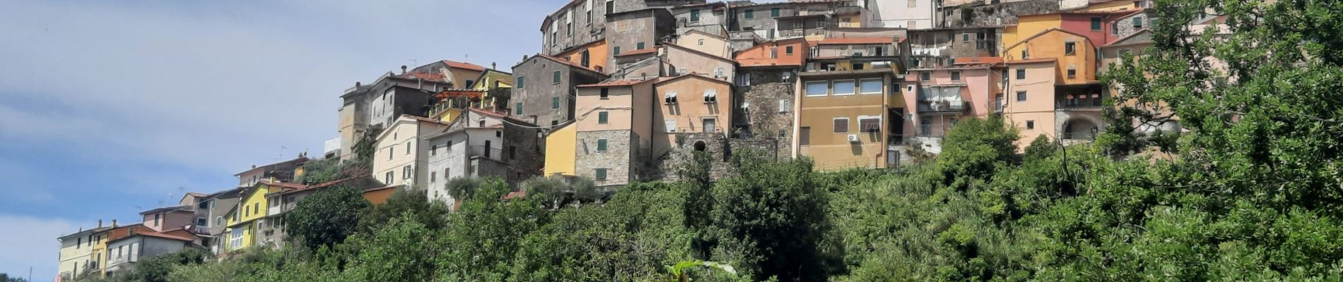
Trail Walking of 20 km to be discovered at Tuscany, Massa-Carrara, Aulla. This trail is proposed by patrickdanilo.
Description
Randonnée Marche de 20 km à découvrir à Toscane, Massa-Carrara, Aulla. Cette randonnée est proposée par patrickdanilo.
Photos


Positioning
Country:
Italy
Region :
Tuscany
Department/Province :
Massa-Carrara
Municipality :
Aulla
Location:
Unknown
Start:(Dec)
Start:(UTM)
577345 ; 4895929 (32T) N.
Comments