


Trace G2 Larribet

mitch1952
User
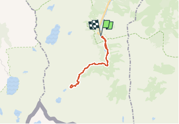

Length
12.5 km

Max alt
2162 m

Uphill gradient
751 m
Km-Effort
23 km

Min alt
1476 m

Downhill gradient
750 m
Boucle
Yes
Creation date :
2022-06-14 07:27:27.0
Updated on :
2022-06-15 20:05:08.785
5h46
Difficulty : Unknown

FREE GPS app for hiking
 SityTrail
IGN / Geographical institutes
SityTrail Plus
The world is yours!
About
Trail Walking of 12.5 km to be discovered at Occitania, Hautespyrenees, Arrens-Marsous. This trail is proposed by mitch1952.
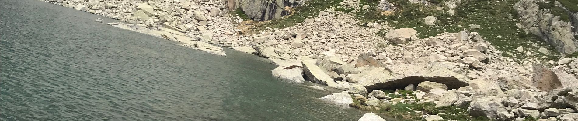
Photos

Positioning
Country:
France
Region :
Occitania
Department/Province :
Hautespyrenees
Municipality :
Arrens-Marsous
Location:
Unknown
Start:(Dec)
Start:(UTM)
722892 ; 4751489 (30T) N.
Comments