


20220614 Vascoeuil

Childebert
User
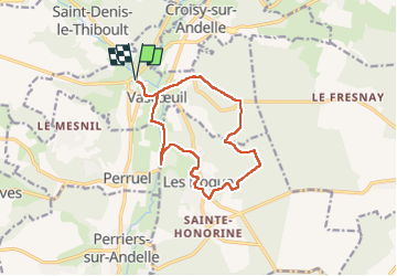

Length
12.4 km

Max alt
182 m

Uphill gradient
289 m
Km-Effort
16.3 km

Min alt
52 m

Downhill gradient
289 m
Boucle
Yes
Creation date :
2022-06-14 11:57:46.136
Updated on :
2022-06-14 20:15:04.373
3h31
Difficulty : Medium

FREE GPS app for hiking
 SityTrail
IGN / Geographical institutes
SityTrail Plus
The world is yours!
About
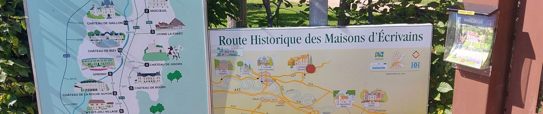
Trail Walking of 12.4 km to be discovered at Normandy, Eure, Vascœuil. This trail is proposed by Childebert.
Photos

Positioning
Country:
France
Region :
Normandy
Department/Province :
Eure
Municipality :
Vascœuil
Location:
Unknown
Start:(Dec)
Start:(UTM)
382296 ; 5478464 (31U) N.
Comments