


Varennes Aydat

JeanPierreNancy
User

Length
56 km

Max alt
1037 m

Uphill gradient
1062 m
Km-Effort
70 km

Min alt
725 m

Downhill gradient
1062 m
Boucle
Yes
Creation date :
2022-06-16 06:59:04.675
Updated on :
2022-06-16 13:32:57.742
3h50
Difficulty : Difficult

FREE GPS app for hiking
 SityTrail
IGN / Geographical institutes
SityTrail Plus
The world is yours!
About
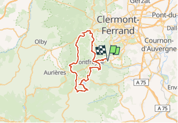
Trail Mountain bike of 56 km to be discovered at Auvergne-Rhône-Alpes, Puy-de-Dôme, Chanonat. This trail is proposed by JeanPierreNancy.
Positioning
Country:
France
Region :
Auvergne-Rhône-Alpes
Department/Province :
Puy-de-Dôme
Municipality :
Chanonat
Location:
Unknown
Start:(Dec)
Start:(UTM)
504257 ; 5061349 (31T) N.
Comments