


Monts - la Horaie Circuit avec routes - 16.6km 130m 3h40 - 2022 06 16

Orcal37
User GUIDE
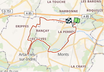

Length
16.6 km

Max alt
95 m

Uphill gradient
132 m
Km-Effort
18.3 km

Min alt
46 m

Downhill gradient
132 m
Boucle
Yes
Creation date :
2022-06-16 12:53:36.419
Updated on :
2022-06-16 18:48:51.747
3h40
Difficulty : Easy

FREE GPS app for hiking
 SityTrail
IGN / Geographical institutes
SityTrail Plus
The world is yours!
About
Trail Walking of 16.6 km to be discovered at Centre-Loire Valley, Indre-et-Loire, Monts. This trail is proposed by Orcal37.
Description
Monts - la Horaie - Circuit avec beaucoup de routes - 16.6km 130m 3h40 - 2022 06 16
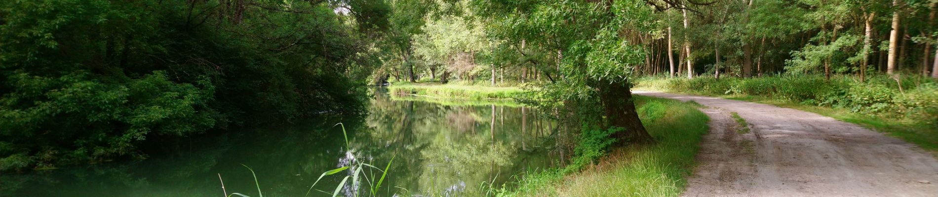
Photos


Positioning
Country:
France
Region :
Centre-Loire Valley
Department/Province :
Indre-et-Loire
Municipality :
Monts
Location:
Unknown
Start:(Dec)
Start:(UTM)
322654 ; 5240857 (31T) N.
Comments