


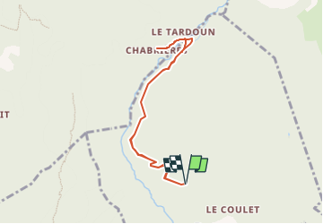
Canal de Braux - Chabriéres -AR

soca
User

Length
8 km

Max alt
1042 m

Uphill gradient
182 m
Km-Effort
10.4 km

Min alt
988 m

Downhill gradient
181 m
Boucle
Yes
Creation date :
2022-06-17 16:00:00.104
Updated on :
2022-06-17 16:06:36.482
2h30
Difficulty : Easy

FREE GPS app for hiking
 SityTrail
IGN / Geographical institutes
SityTrail Plus
The world is yours!
About
Trail Walking of 8 km to be discovered at Provence-Alpes-Côte d'Azur, Alpes-de-Haute-Provence, Braux. This trail is proposed by soca.
Positioning
Country:
France
Region :
Provence-Alpes-Côte d'Azur
Department/Province :
Alpes-de-Haute-Provence
Municipality :
Braux
Location:
Unknown
Start:(Dec)
Start:(UTM)
315101 ; 4873706 (32T) N.
Comments