


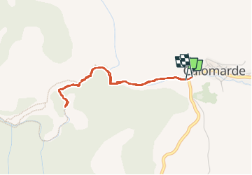
canon de los arcos

lablaquiere
User

Length
3.8 km

Max alt
1371 m

Uphill gradient
125 m
Km-Effort
5.5 km

Min alt
1313 m

Downhill gradient
130 m
Boucle
Yes
Creation date :
2022-06-17 14:50:56.107
Updated on :
2022-06-17 16:22:30.853
1h07
Difficulty : Easy

FREE GPS app for hiking
 SityTrail
IGN / Geographical institutes
SityTrail Plus
The world is yours!
About
Trail Walking of 3.8 km to be discovered at Aragon, Teruel, Calomarde. This trail is proposed by lablaquiere.
Positioning
Country:
Spain
Region :
Aragon
Department/Province :
Teruel
Municipality :
Calomarde
Location:
Unknown
Start:(Dec)
Start:(UTM)
620674 ; 4469977 (30T) N.
Comments