


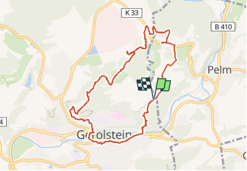
Eifelsteig Gerolstein

Geert H.
User

Length
9 km

Max alt
528 m

Uphill gradient
307 m
Km-Effort
13.1 km

Min alt
357 m

Downhill gradient
305 m
Boucle
Yes
Creation date :
2022-06-18 11:29:35.078
Updated on :
2022-06-19 08:03:51.536
1h37
Difficulty : Medium

FREE GPS app for hiking
 SityTrail
IGN / Geographical institutes
SityTrail Plus
The world is yours!
About
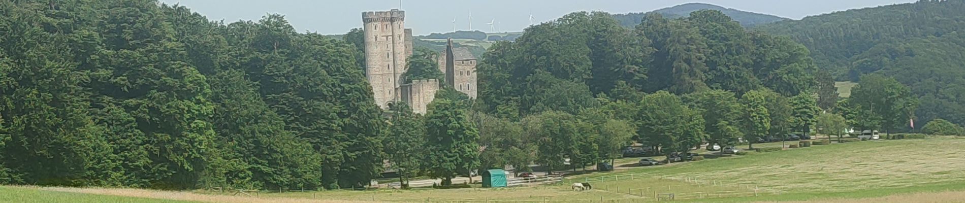
Trail Walking of 9 km to be discovered at Rhineland-Palatinate, Landkreis Vulkaneifel, Gerolstein. This trail is proposed by Geert H..
Photos


Positioning
Country:
Germany
Region :
Rhineland-Palatinate
Department/Province :
Landkreis Vulkaneifel
Municipality :
Gerolstein
Location:
Unknown
Start:(Dec)
Start:(UTM)
334131 ; 5566679 (32U) N.
Comments