


défi Blaireaux

bouscaillou
User
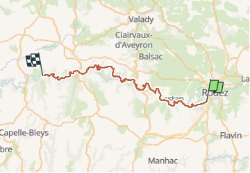

Length
48 km

Max alt
631 m

Uphill gradient
1242 m
Km-Effort
66 km

Min alt
381 m

Downhill gradient
1445 m
Boucle
No
Creation date :
2022-06-18 04:05:50.732
Updated on :
2022-06-18 17:19:27.049
13h12
Difficulty : Very difficult

FREE GPS app for hiking
 SityTrail
IGN / Geographical institutes
SityTrail Plus
The world is yours!
About
Trail Walking of 48 km to be discovered at Occitania, Aveyron, Olemps. This trail is proposed by bouscaillou.
Positioning
Country:
France
Region :
Occitania
Department/Province :
Aveyron
Municipality :
Olemps
Location:
Unknown
Start:(Dec)
Start:(UTM)
464522 ; 4909541 (31T) N.
Comments