


Les Écrins les Orgues de Valsenestre

c.gourme
User
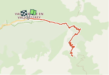

Length
12.9 km

Max alt
2306 m

Uphill gradient
1012 m
Km-Effort
26 km

Min alt
1300 m

Downhill gradient
1012 m
Boucle
Yes
Creation date :
2022-06-18 06:30:41.0
Updated on :
2022-06-19 09:50:25.79
5h25
Difficulty : Medium

FREE GPS app for hiking
 SityTrail
IGN / Geographical institutes
SityTrail Plus
The world is yours!
About
Trail Walking of 12.9 km to be discovered at Auvergne-Rhône-Alpes, Isère, Valjouffrey. This trail is proposed by c.gourme.
Positioning
Country:
France
Region :
Auvergne-Rhône-Alpes
Department/Province :
Isère
Municipality :
Valjouffrey
Location:
Unknown
Start:(Dec)
Start:(UTM)
267485 ; 4976917 (32T) N.
Comments