


Les Trois Col

GOHIER
User

Length
11.9 km

Max alt
2511 m

Uphill gradient
750 m
Km-Effort
22 km

Min alt
2160 m

Downhill gradient
751 m
Boucle
Yes
Creation date :
2022-06-19 06:38:08.0
Updated on :
2022-06-19 17:44:55.26
7h54
Difficulty : Medium

FREE GPS app for hiking
 SityTrail
IGN / Geographical institutes
SityTrail Plus
The world is yours!
About
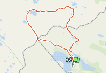
Trail Walking of 11.9 km to be discovered at Occitania, Hautespyrenees, Vielle-Aure. This trail is proposed by GOHIER.
Description
Lac d’Aubert, col de Madamette, lac de Madamette, col de Tracens, lac Nere, lac Estagnol, Hourquette d’Aubert.
Positioning
Country:
France
Region :
Occitania
Department/Province :
Hautespyrenees
Municipality :
Vielle-Aure
Location:
Unknown
Start:(Dec)
Start:(UTM)
266591 ; 4747067 (31T) N.
Comments