


projet lac de l'Hivernet

orsel
User GUIDE

Length
3.3 km

Max alt
2353 m

Uphill gradient
741 m
Km-Effort
10.7 km

Min alt
1603 m

Downhill gradient
0 m
Boucle
No
Creation date :
2022-06-19 20:17:42.209
Updated on :
2022-06-19 20:18:28.328
2h26
Difficulty : Easy

FREE GPS app for hiking
 SityTrail
IGN / Geographical institutes
SityTrail Plus
The world is yours!
About
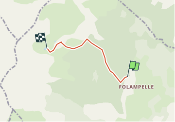
Trail On foot of 3.3 km to be discovered at Provence-Alpes-Côte d'Azur, Hautes-Alpes, Embrun. This trail is proposed by orsel.
Positioning
Country:
France
Region :
Provence-Alpes-Côte d'Azur
Department/Province :
Hautes-Alpes
Municipality :
Embrun
Location:
Unknown
Start:(Dec)
Start:(UTM)
299614 ; 4940898 (32T) N.
Comments