


wut

Christine Torfs
User
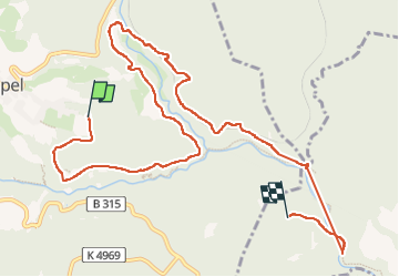

Length
10.8 km

Max alt
875 m

Uphill gradient
274 m
Km-Effort
14.7 km

Min alt
717 m

Downhill gradient
363 m
Boucle
No
Creation date :
2022-06-20 07:44:06.072
Updated on :
2022-06-20 12:17:48.887
2h34
Difficulty : Difficult

FREE GPS app for hiking
 SityTrail
IGN / Geographical institutes
SityTrail Plus
The world is yours!
About
Trail Walking of 10.8 km to be discovered at Baden-Württemberg, Landkreis Breisgau-Hochschwarzwald, Lenzkirch. This trail is proposed by Christine Torfs.
Description
pieds
Positioning
Country:
Germany
Region :
Baden-Württemberg
Department/Province :
Landkreis Breisgau-Hochschwarzwald
Municipality :
Lenzkirch
Location:
Unknown
Start:(Dec)
Start:(UTM)
443653 ; 5302110 (32T) N.
Comments