


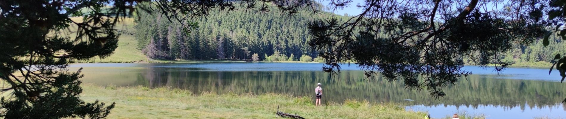
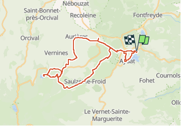
Les 2 lacs

duchaine.nicolas
User

Length
34 km

Max alt
1215 m

Uphill gradient
658 m
Km-Effort
43 km

Min alt
839 m

Downhill gradient
655 m
Boucle
Yes
Creation date :
2022-06-23 07:02:00.924
Updated on :
2022-06-23 09:47:36.999
2h41
Difficulty : Easy
2h41
Difficulty : Easy

FREE GPS app for hiking
 SityTrail
IGN / Geographical institutes
SityTrail Plus
The world is yours!
About
Trail Mountain bike of 34 km to be discovered at Auvergne-Rhône-Alpes, Puy-de-Dôme, Aydat. This trail is proposed by duchaine.nicolas.
Photos


Positioning
Country:
France
Region :
Auvergne-Rhône-Alpes
Department/Province :
Puy-de-Dôme
Municipality :
Aydat
Location:
Unknown
Start:(Dec)
Start:(UTM)
499156 ; 5057386 (31T) N.
Comments