


Jakobsweg 2a

steger12
User
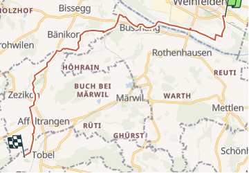

Length
13.7 km

Max alt
549 m

Uphill gradient
251 m
Km-Effort
16.7 km

Min alt
419 m

Downhill gradient
146 m
Boucle
No
Creation date :
2014-12-10 00:00:00.0
Updated on :
2014-12-10 00:00:00.0
--
Difficulty : Unknown

FREE GPS app for hiking
 SityTrail
IGN / Geographical institutes
SityTrail Plus
The world is yours!
About
Trail Other activity of 13.7 km to be discovered at Thurgau, Bezirk Weinfelden, Weinfelden. This trail is proposed by steger12.
Positioning
Country:
Switzerland
Region :
Thurgau
Department/Province :
Bezirk Weinfelden
Municipality :
Weinfelden
Location:
Unknown
Start:(Dec)
Start:(UTM)
509186 ; 5267583 (32T) N.
Comments