


Plage de Lentevez -Porlous

psesjs
User

Length
5.7 km

Max alt
39 m

Uphill gradient
85 m
Km-Effort
6.8 km

Min alt
0 m

Downhill gradient
80 m
Boucle
No
Creation date :
2022-06-23 13:18:15.0
Updated on :
2022-06-23 14:49:12.508
1h24
Difficulty : Medium

FREE GPS app for hiking
 SityTrail
IGN / Geographical institutes
SityTrail Plus
The world is yours!
About
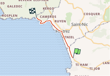
Trail Walking of 5.7 km to be discovered at Brittany, Finistère, Plomodiern. This trail is proposed by psesjs.
Positioning
Country:
France
Region :
Brittany
Department/Province :
Finistère
Municipality :
Plomodiern
Location:
Unknown
Start:(Dec)
Start:(UTM)
404031 ; 5336690 (30U) N.
Comments