


Alsbach

Mercenier
User
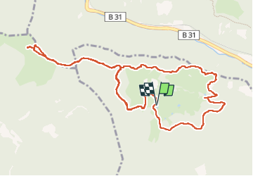

Length
14.4 km

Max alt
1191 m

Uphill gradient
442 m
Km-Effort
20 km

Min alt
926 m

Downhill gradient
448 m
Boucle
Yes
Creation date :
2022-06-23 08:17:00.201
Updated on :
2022-06-24 07:46:08.521
6h10
Difficulty : Very difficult

FREE GPS app for hiking
 SityTrail
IGN / Geographical institutes
SityTrail Plus
The world is yours!
About
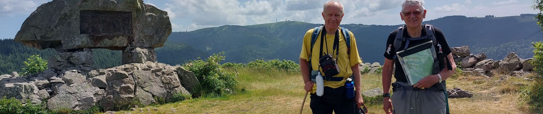
Trail Walking of 14.4 km to be discovered at Baden-Württemberg, Landkreis Breisgau-Hochschwarzwald, Hinterzarten. This trail is proposed by Mercenier.
Photos


Positioning
Country:
Germany
Region :
Baden-Württemberg
Department/Province :
Landkreis Breisgau-Hochschwarzwald
Municipality :
Hinterzarten
Location:
Unknown
Start:(Dec)
Start:(UTM)
428874 ; 5306701 (32T) N.
Comments