


les chalets des Acles

aljac
User

Length
11.3 km

Max alt
1943 m

Uphill gradient
539 m
Km-Effort
18.5 km

Min alt
1487 m

Downhill gradient
538 m
Boucle
Yes
Creation date :
2022-06-24 06:10:01.479
Updated on :
2022-06-24 09:59:34.859
3h48
Difficulty : Medium

FREE GPS app for hiking
 SityTrail
IGN / Geographical institutes
SityTrail Plus
The world is yours!
About
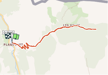
Trail Walking of 11.3 km to be discovered at Provence-Alpes-Côte d'Azur, Hautes-Alpes, Névache. This trail is proposed by aljac.
Positioning
Country:
France
Region :
Provence-Alpes-Côte d'Azur
Department/Province :
Hautes-Alpes
Municipality :
Névache
Location:
Unknown
Start:(Dec)
Start:(UTM)
315663 ; 4986019 (32T) N.
Comments