


Frutt - Tannensee - Bonistock

steger12
User
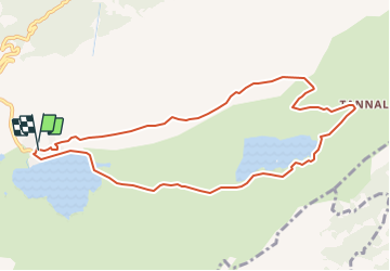

Length
9.7 km

Max alt
2172 m

Uphill gradient
331 m
Km-Effort
14.1 km

Min alt
1892 m

Downhill gradient
322 m
Boucle
Yes
Creation date :
2014-12-10 00:00:00.0
Updated on :
2014-12-10 00:00:00.0
--
Difficulty : Unknown

FREE GPS app for hiking
 SityTrail
IGN / Geographical institutes
SityTrail Plus
The world is yours!
About
Trail Other activity of 9.7 km to be discovered at Obwalden. This trail is proposed by steger12.
Positioning
Country:
Switzerland
Region :
Obwalden
Department/Province :
Kerns
Municipality :
Kerns
Location:
Unknown
Start:(Dec)
Start:(UTM)
444174 ; 5180359 (32T) N.
Comments