Trail Cycle Draguignan - Cotignac - Photo
 Sugg
Sugg

User

© OpenStreetMap contributors
Length
Length
76 km
Max alt
Max alt
285 m
Uphill gradient
Uphill gradient
1033 m
Km-Effort
Km-Effort  
90 km
Min alt
Min alt
100 m
Downhill gradient
Downhill gradient
1033 m
Boucle
Boucle
Yes
Creation date :
2019-03-22 17:00:06.118
Updated on :
2019-03-22 17:00:06.19

(0 Reviews)

Cycle
Cycle
5h10
Difficulty : Easy

Scan this QR Code to open this trail in the SityTrail application

FREE GPS app for hiking

Logo SityTrail SityTrail

IGN / Geographical institutes

Download SityTrail from the App Store Download SityTrail from Google Play

Logo SityTrail SityTrail Plus

The world is yours!

Download SityTrail from the App Store Download SityTrail from Google Play Download SityTrail on Huawei AppGallery

About

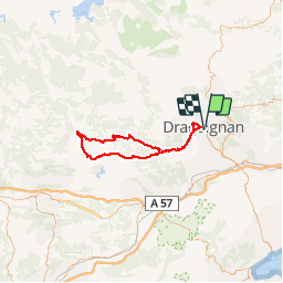
Trail Cycle of 76 km to be discovered at Provence-Alpes-Côte d'Azur, Var, Draguignan. This trail is proposed by Sugg.

Description

Bonjour,
Sortie RF vélo du 31-07-14.
Circuit proposé par Michel.
En gros : 3h24 de roulage, 77 kms, 22.8 de moyenne ( pour moi ).
Petit café à Entrecasteaux sur la terrasse face au château.
La vie est belle ( comme la serveuse .....chuttttttttt.)Michel est en vacances jusqu'au 20 ou 21 Août, circuit proposé par Alain.
A bientôt sur les routes du Var.
Fernand.
PS : quelques différences entre les relevés automatiques sur cette carte et mon compteur, mais bon !!!!

Elevation profile

Positioning

Country:
France
Region :
Provence-Alpes-Côte d'Azur
Department/Province :
Var
Municipality :
Draguignan
Location:
Unknown
Start:(UTM)
295229 ; 4823009 (32T) N.


Close
My subscriptions