


Tour du Mont Chauffé

reneperrin
User
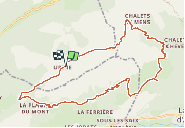

Length
12.7 km

Max alt
1699 m

Uphill gradient
791 m
Km-Effort
23 km

Min alt
1238 m

Downhill gradient
795 m
Boucle
Yes
Creation date :
2022-06-26 06:53:42.345
Updated on :
2022-06-26 15:25:57.337
5h12
Difficulty : Medium

FREE GPS app for hiking
 SityTrail
IGN / Geographical institutes
SityTrail Plus
The world is yours!
About
Trail Walking of 12.7 km to be discovered at Auvergne-Rhône-Alpes, Upper Savoy, Vacheresse. This trail is proposed by reneperrin.
Description
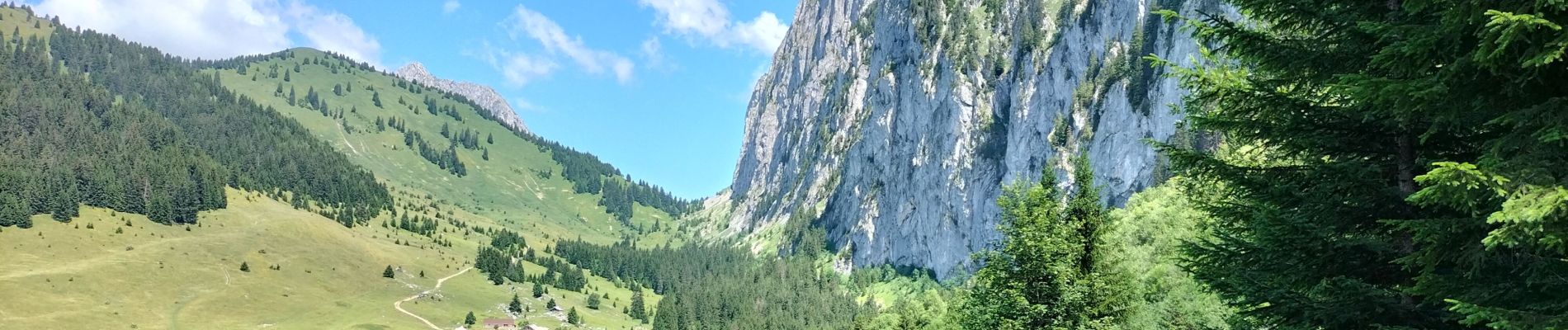
au départ du refuge d'Ubine
Photos


Positioning
Country:
France
Region :
Auvergne-Rhône-Alpes
Department/Province :
Upper Savoy
Municipality :
Vacheresse
Location:
Unknown
Start:(Dec)
Start:(UTM)
326237 ; 5130605 (32T) N.
Comments