


Franchevelle

PatriceCocuaud
User
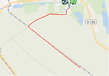

Length
5 km

Max alt
329 m

Uphill gradient
58 m
Km-Effort
5.7 km

Min alt
299 m

Downhill gradient
58 m
Boucle
Yes
Creation date :
2022-06-27 13:26:38.735
Updated on :
2022-06-27 14:17:58.181
51m
Difficulty : Very easy

FREE GPS app for hiking
 SityTrail
IGN / Geographical institutes
SityTrail Plus
The world is yours!
About
Trail Walking of 5 km to be discovered at Bourgogne-Franche-Comté, Haute-Saône, Franchevelle. This trail is proposed by PatriceCocuaud.
Positioning
Country:
France
Region :
Bourgogne-Franche-Comté
Department/Province :
Haute-Saône
Municipality :
Franchevelle
Location:
Unknown
Start:(Dec)
Start:(UTM)
309544 ; 5290286 (32T) N.
Comments