


Val Bavone

steger12
User
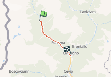

Length
9.7 km

Max alt
812 m

Uphill gradient
55 m
Km-Effort
11.7 km

Min alt
437 m

Downhill gradient
424 m
Boucle
No
Creation date :
2014-12-10 00:00:00.0
Updated on :
2014-12-10 00:00:00.0
--
Difficulty : Unknown

FREE GPS app for hiking
 SityTrail
IGN / Geographical institutes
SityTrail Plus
The world is yours!
About
Trail Other activity of 9.7 km to be discovered at Ticino, Distretto di Vallemaggia, Cevio. This trail is proposed by steger12.
Positioning
Country:
Switzerland
Region :
Ticino
Department/Province :
Distretto di Vallemaggia
Municipality :
Cevio
Location:
Unknown
Start:(Dec)
Start:(UTM)
464453 ; 5137985 (32T) N.
Comments