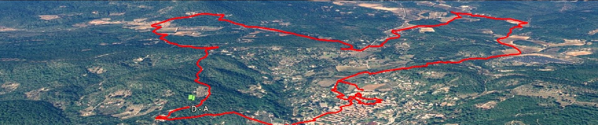
Trace_Cotignac

affinetataille
User GUIDE
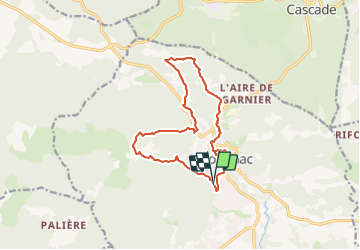

Length
14.9 km

Max alt
449 m

Uphill gradient
386 m
Km-Effort
20 km

Min alt
220 m

Downhill gradient
387 m
Boucle
Yes
Creation date :
2022-06-28 10:56:26.306
Updated on :
2023-06-16 08:03:47.338
6h00
Difficulty : Medium

FREE GPS app for hiking
 SityTrail
IGN / Geographical institutes
SityTrail Plus
The world is yours!
About
Trail Walking of 14.9 km to be discovered at Provence-Alpes-Côte d'Azur, Var, Cotignac. This trail is proposed by affinetataille.
Photos


42 photos in total. Please click on a photo to see them all in the gallery.
Positioning
Country:
France
Region :
Provence-Alpes-Côte d'Azur
Department/Province :
Var
Municipality :
Cotignac
Location:
Unknown
Start:(Dec)
Start:(UTM)
269338 ; 4822725 (32T) N.
Comments