


cirque de la glere

ego
User
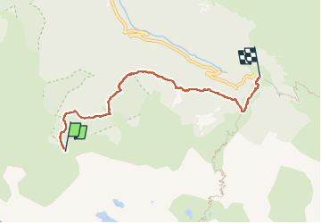

Length
5.5 km

Max alt
1647 m

Uphill gradient
85 m
Km-Effort
7.3 km

Min alt
1381 m

Downhill gradient
292 m
Boucle
No
Creation date :
2022-06-29 12:24:01.615
Updated on :
2022-06-29 14:36:21.749
1h47
Difficulty : Medium

FREE GPS app for hiking
 SityTrail
IGN / Geographical institutes
SityTrail Plus
The world is yours!
About
Trail Walking of 5.5 km to be discovered at Occitania, Haute-Garonne, Bagnères-de-Luchon. This trail is proposed by ego .
Positioning
Country:
France
Region :
Occitania
Department/Province :
Haute-Garonne
Municipality :
Bagnères-de-Luchon
Location:
Unknown
Start:(Dec)
Start:(UTM)
304893 ; 4731404 (31T) N.
Comments