


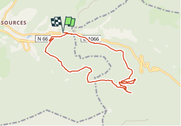
Col de Bussang - GR 531 - Chalet St Hubert - Col des Allemands - Chemin des Ormes et retour

patrickbeyrath
User

Length
8.5 km

Max alt
933 m

Uphill gradient
374 m
Km-Effort
13.5 km

Min alt
717 m

Downhill gradient
371 m
Boucle
Yes
Creation date :
2022-07-01 05:42:42.162
Updated on :
2022-07-01 05:56:17.361
2h21
Difficulty : Medium

FREE GPS app for hiking
 SityTrail
IGN / Geographical institutes
SityTrail Plus
The world is yours!
About
Trail Walking of 8.5 km to be discovered at Grand Est, Vosges, Bussang. This trail is proposed by patrickbeyrath.
Positioning
Country:
France
Region :
Grand Est
Department/Province :
Vosges
Municipality :
Bussang
Location:
Unknown
Start:(Dec)
Start:(UTM)
342527 ; 5306185 (32T) N.
Comments