


SityTrail - chartres

olivieraron
User
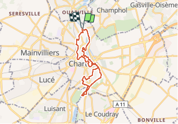

Length
12.8 km

Max alt
164 m

Uphill gradient
146 m
Km-Effort
14.8 km

Min alt
123 m

Downhill gradient
153 m
Boucle
Yes
Creation date :
2022-07-01 05:56:21.859
Updated on :
2022-07-01 05:56:21.859

FREE GPS app for hiking
 SityTrail
IGN / Geographical institutes
SityTrail Plus
The world is yours!
About
Trail of 12.8 km to be discovered at Centre-Loire Valley, Eure-et-Loir, Chartres. This trail is proposed by olivieraron.
Description
marche
Positioning
Country:
France
Region :
Centre-Loire Valley
Department/Province :
Eure-et-Loir
Municipality :
Chartres
Location:
Unknown
Start:(Dec)
Start:(UTM)
388209 ; 5368502 (31U) N.
Comments