


la de bordères -col de balès

ego
User
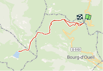

Length
10 km

Max alt
1870 m

Uphill gradient
326 m
Km-Effort
14.4 km

Min alt
1736 m

Downhill gradient
327 m
Boucle
Yes
Creation date :
2022-07-01 10:47:05.909
Updated on :
2022-07-01 17:10:46.307
3h06
Difficulty : Medium

FREE GPS app for hiking
 SityTrail
IGN / Geographical institutes
SityTrail Plus
The world is yours!
About
Trail Walking of 10 km to be discovered at Occitania, Haute-Garonne, Bourg-d'Oueil. This trail is proposed by ego .
Positioning
Country:
France
Region :
Occitania
Department/Province :
Haute-Garonne
Municipality :
Bourg-d'Oueil
Location:
Unknown
Start:(Dec)
Start:(UTM)
295879 ; 4749843 (31T) N.
Comments