


binic

canuardg
User

Length
3.8 km

Max alt
78 m

Uphill gradient
74 m
Km-Effort
4.7 km

Min alt
13 m

Downhill gradient
54 m
Boucle
No
Creation date :
2022-07-02 09:24:30.795
Updated on :
2022-07-02 10:24:15.47
59m
Difficulty : Easy

FREE GPS app for hiking
 SityTrail
IGN / Geographical institutes
SityTrail Plus
The world is yours!
About
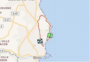
Trail Walking of 3.8 km to be discovered at Brittany, Côtes-d'Armor, Binic-Étables-sur-Mer. This trail is proposed by canuardg.
Positioning
Country:
France
Region :
Brittany
Department/Province :
Côtes-d'Armor
Municipality :
Binic-Étables-sur-Mer
Location:
Binic
Start:(Dec)
Start:(UTM)
513382 ; 5383937 (30U) N.
Comments