


Antecime Pic de Monbrison

orsel
User GUIDE
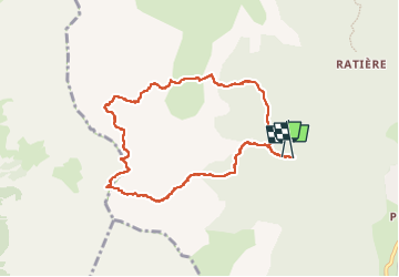

Length
9.1 km

Max alt
2742 m

Uphill gradient
1028 m
Km-Effort
23 km

Min alt
1710 m

Downhill gradient
1032 m
Boucle
Yes
Creation date :
2022-07-02 06:35:26.466
Updated on :
2022-07-02 16:00:26.285
6h58
Difficulty : Difficult

FREE GPS app for hiking
 SityTrail
IGN / Geographical institutes
SityTrail Plus
The world is yours!
About
Trail Walking of 9.1 km to be discovered at Provence-Alpes-Côte d'Azur, Hautes-Alpes, Saint-Martin-de-Queyrières. This trail is proposed by orsel.
Description
2 juillet
Positioning
Country:
France
Region :
Provence-Alpes-Côte d'Azur
Department/Province :
Hautes-Alpes
Municipality :
Saint-Martin-de-Queyrières
Location:
Unknown
Start:(Dec)
Start:(UTM)
307307 ; 4970213 (32T) N.
Comments