


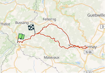
Ballon d'Alsace-Cernay

philsutter
User

Length
62 km

Max alt
1245 m

Uphill gradient
1913 m
Km-Effort
88 km

Min alt
298 m

Downhill gradient
1985 m
Boucle
No
Creation date :
2018-05-22 00:00:00.0
Updated on :
2020-06-02 18:53:31.918
10h24
Difficulty : Very difficult

FREE GPS app for hiking
 SityTrail
IGN / Geographical institutes
SityTrail Plus
The world is yours!
About
Trail Walking of 62 km to be discovered at Grand Est, Vosges, Saint-Maurice-sur-Moselle. This trail is proposed by philsutter.
Positioning
Country:
France
Region :
Grand Est
Department/Province :
Vosges
Municipality :
Saint-Maurice-sur-Moselle
Location:
Unknown
Start:(Dec)
Start:(UTM)
337938 ; 5298607 (32T) N.
Comments