


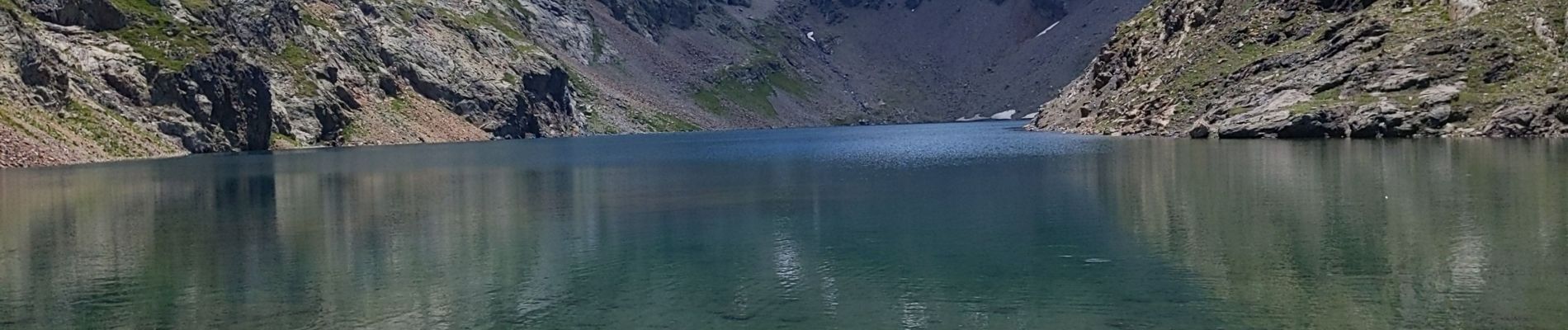
lac du vallon 3 7 22

bymarc26
User
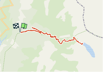

Length
11.4 km

Max alt
2498 m

Uphill gradient
1132 m
Km-Effort
27 km

Min alt
1375 m

Downhill gradient
1144 m
Boucle
Yes
Creation date :
2022-07-03 07:05:49.969
Updated on :
2022-07-03 14:40:56.68
4h29
Difficulty : Difficult

FREE GPS app for hiking
 SityTrail
IGN / Geographical institutes
SityTrail Plus
The world is yours!
About
Trail Walking of 11.4 km to be discovered at Auvergne-Rhône-Alpes, Isère, Chantepérier. This trail is proposed by bymarc26.
Photos


Positioning
Country:
France
Region :
Auvergne-Rhône-Alpes
Department/Province :
Isère
Municipality :
Chantepérier
Location:
Chantelouve
Start:(Dec)
Start:(UTM)
734727 ; 4985585 (31T) N.
Comments