


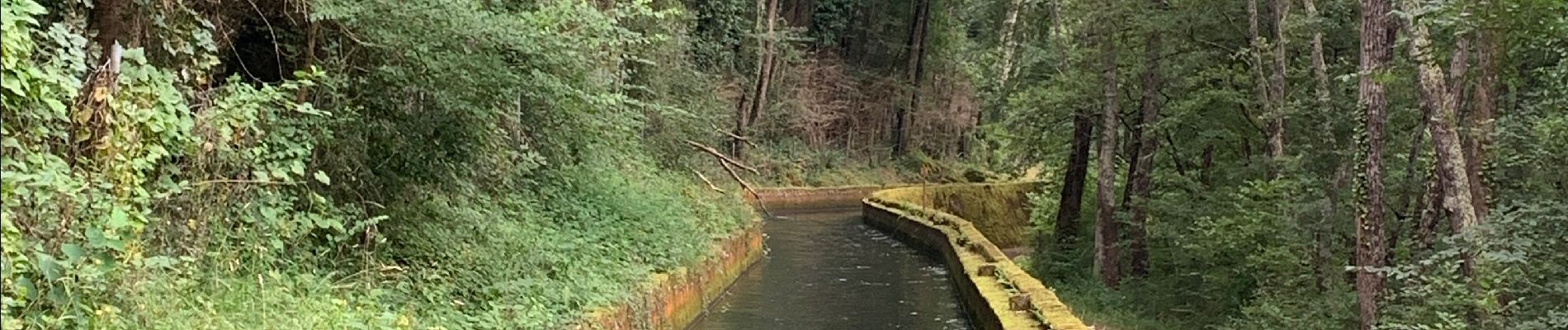
St girons la cascade d Aubert

viaul
User GUIDE
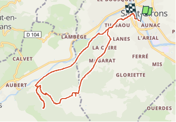

Length
11.9 km

Max alt
683 m

Uphill gradient
440 m
Km-Effort
17.7 km

Min alt
393 m

Downhill gradient
440 m
Boucle
Yes
Creation date :
2022-07-04 12:58:49.0
Updated on :
2022-07-04 17:12:44.161
3h03
Difficulty : Medium

FREE GPS app for hiking
 SityTrail
IGN / Geographical institutes
SityTrail Plus
The world is yours!
About
Trail Walking of 11.9 km to be discovered at Occitania, Ariège, Saint-Girons. This trail is proposed by viaul.
Photos


Positioning
Country:
France
Region :
Occitania
Department/Province :
Ariège
Municipality :
Saint-Girons
Location:
Unknown
Start:(Dec)
Start:(UTM)
348761 ; 4760502 (31T) N.
Comments
Bonsoir, Félicitations et merci pour cet échange..n'y aurait il pas une petite spéciale que j'aperçois sur le tracé ? Bises et bonne nuit.