


Allondrelle Les lundis en balade 2022

toffee
User
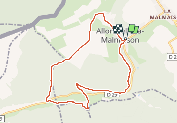

Length
9 km

Max alt
365 m

Uphill gradient
245 m
Km-Effort
12.2 km

Min alt
233 m

Downhill gradient
245 m
Boucle
Yes
Creation date :
2022-07-04 17:26:33.62
Updated on :
2022-07-08 16:43:31.389
2h55
Difficulty : Very difficult

FREE GPS app for hiking
 SityTrail
IGN / Geographical institutes
SityTrail Plus
The world is yours!
About
Trail Walking of 9 km to be discovered at Grand Est, Meurthe-et-Moselle, Allondrelle-la-Malmaison. This trail is proposed by toffee.
Positioning
Country:
France
Region :
Grand Est
Department/Province :
Meurthe-et-Moselle
Municipality :
Allondrelle-la-Malmaison
Location:
Unknown
Start:(Dec)
Start:(UTM)
685759 ; 5487278 (31U) N.
Comments