


J4 devoluy Treminis la jarjatte

ophness
User
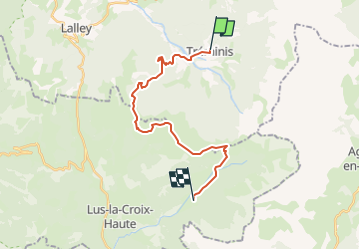

Length
21 km

Max alt
1860 m

Uphill gradient
1462 m
Km-Effort
39 km

Min alt
852 m

Downhill gradient
1225 m
Boucle
No
Creation date :
2022-07-05 09:11:54.111
Updated on :
2022-07-05 09:12:19.49
5h10
Difficulty : Difficult

FREE GPS app for hiking
 SityTrail
IGN / Geographical institutes
SityTrail Plus
The world is yours!
About
Trail Horseback riding of 21 km to be discovered at Auvergne-Rhône-Alpes, Isère, Tréminis. This trail is proposed by ophness.
Positioning
Country:
France
Region :
Auvergne-Rhône-Alpes
Department/Province :
Isère
Municipality :
Tréminis
Location:
Unknown
Start:(Dec)
Start:(UTM)
719169 ; 4958600 (31T) N.
Comments