


Col de la core

viaul
User GUIDE
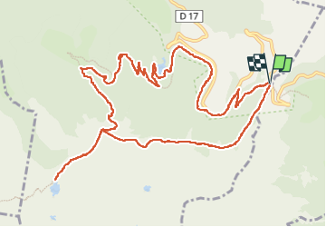

Length
15.6 km

Max alt
1737 m

Uphill gradient
851 m
Km-Effort
27 km

Min alt
1065 m

Downhill gradient
858 m
Boucle
Yes
Creation date :
2022-07-05 07:07:28.0
Updated on :
2022-07-05 13:50:46.633
5h43
Difficulty : Difficult

FREE GPS app for hiking
 SityTrail
IGN / Geographical institutes
SityTrail Plus
The world is yours!
About
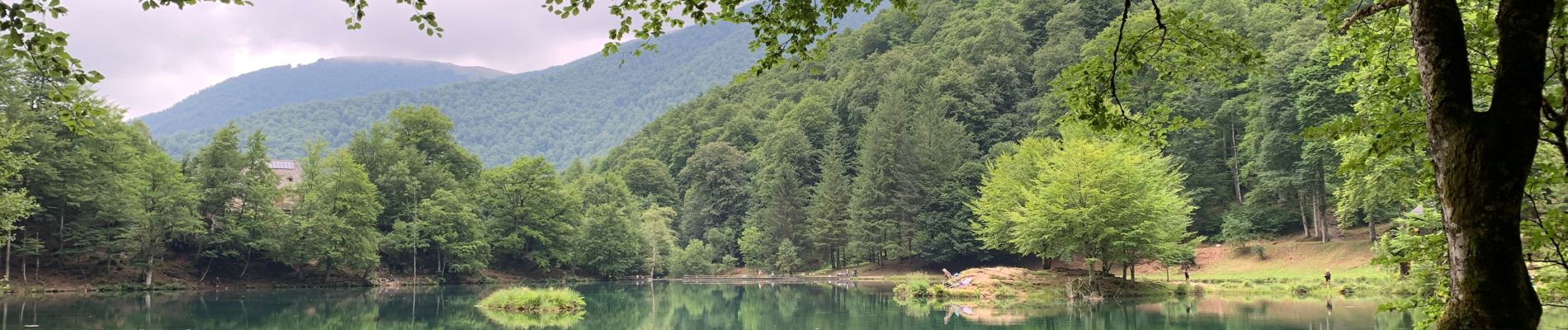
Trail Walking of 15.6 km to be discovered at Occitania, Ariège, Bethmale. This trail is proposed by viaul.
Photos


Positioning
Country:
France
Region :
Occitania
Department/Province :
Ariège
Municipality :
Bethmale
Location:
Unknown
Start:(Dec)
Start:(UTM)
345182 ; 4746874 (31T) N.
Comments