


mmmm

surceneux
User
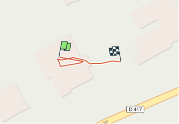

Length
49 m

Max alt
669 m

Uphill gradient
0 m
Km-Effort
49 m

Min alt
668 m

Downhill gradient
0 m
Boucle
No
Creation date :
2022-07-06 07:16:22.92
Updated on :
2022-07-06 07:18:21.014
1m
Difficulty : Easy

FREE GPS app for hiking
 SityTrail
IGN / Geographical institutes
SityTrail Plus
The world is yours!
About
Trail Walking of 49 m to be discovered at Grand Est, Vosges, Gérardmer. This trail is proposed by surceneux.
Positioning
Country:
France
Region :
Grand Est
Department/Province :
Vosges
Municipality :
Gérardmer
Location:
Unknown
Start:(Dec)
Start:(UTM)
342919 ; 5327265 (32U) N.
Comments